Wikimapia [16 November 2008]
Couldn't place this cemetery on Wikimapia. The coordinates map to http://www.wikimapia.org/beta/#lat=38.1892075&lon=-81.345005&z=18&l=0&m=b, but satellite imagery doesn't make it clear that there is a cemetery there. --ceyockey 10:29, 16 November 2008 (EST)
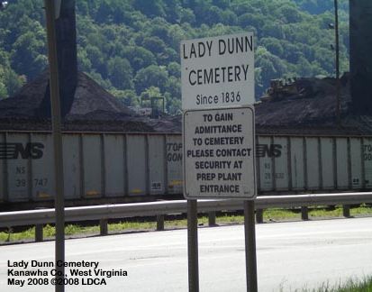
See http://www.wvcpaweb.org/cemeteryregister/Kanawha/KanawhaDunn.html for more information on this cemetery.
--Ronni 11:15, 16 November 2008 (EST)
- Based on the map @ http://www.wvcpaweb.org/cemeteryregister/Kanawha/KanawhaDunnMap.html, I think that http://www.wikimapia.org/beta/#lat=38.1892202&lon=-81.3516462&z=17&l=0&m=b shows the switchback, but I can't confidently place the cinderblock building, the path or a cemetery-like place ... unless all the white splotches about are tombstones, but I don't think that is the case. --ceyockey 14:24, 16 November 2008 (EST)
- However, http://www.wikimapia.org/beta/#lat=38.1855835&lon=-81.3429371&z=19&l=0&m=b might show the "white security shack" mentioned on http://www.wvcpaweb.org/cemeteryregister/Kanawha/KanawhaDunn.html. The picture @ http://www.wvcpaweb.org/cemeteryregister/Kanawha/KanawhaDunn00i.jpg suggests that the sign is right off the north side of route 60 and that coal piles sit on the opposite side of the track ... which is consistent with the map link at the start of this paragraph. --ceyockey 14:33, 16 November 2008 (EST)
|
